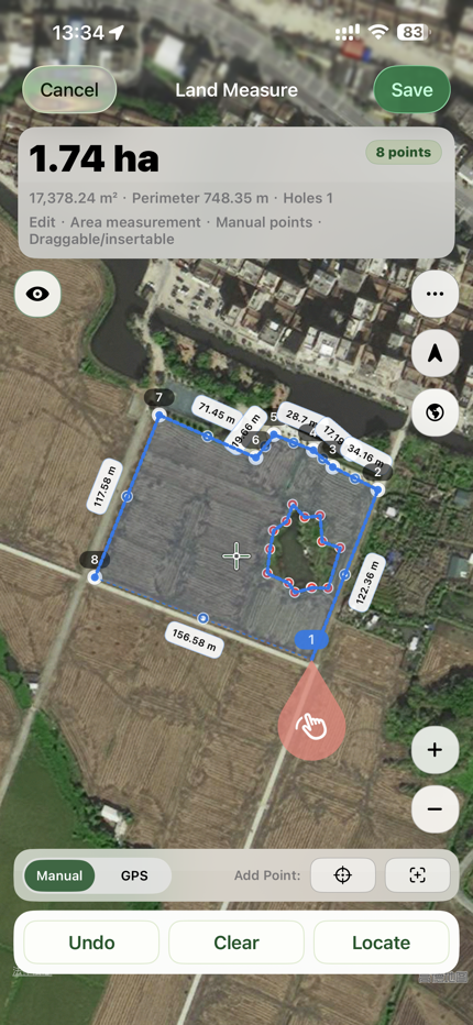
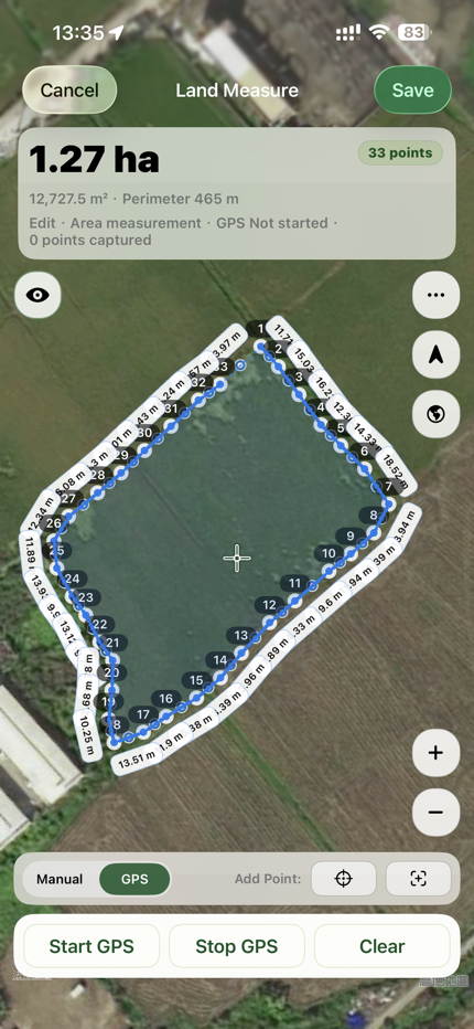
LandMeasure icon Land Area Measure GPS Map Parcel, Distance & GIS Export
LandMeasure App Icon

Land Area Measure GPS Map

Parcel, Distance & GIS Export. Built for real field workflows: capture points, distances, and areas, keep records editable, then export in professional formats.

Manual + GPS Capture Complex Parcel Editing Import & Export Formats Searchable History
App screenshot 1 App screenshot 2 App screenshot 3 App screenshot 4 App screenshot 5 App screenshot 6 App screenshot 7 App screenshot 8

Core Capabilities

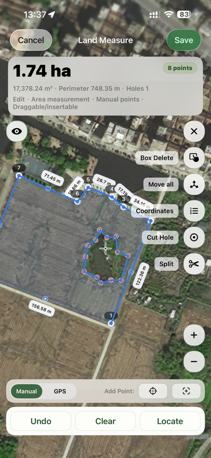
  • Measure points, lines, and areas on one map.
  • Switch between manual pinning and GPS capture.
  • Drag vertices, insert midpoints, split areas, and cut holes.
  • Metrics update in real time while editing.

Usable Record History

  • Search, filter, and review measurement records quickly.
  • Continue editing existing records and save back to source.
  • Detail pages include map, metrics, coordinates, notes, and media.
  • Import preview helps prevent accidental data import.

Professional Exchange

Export

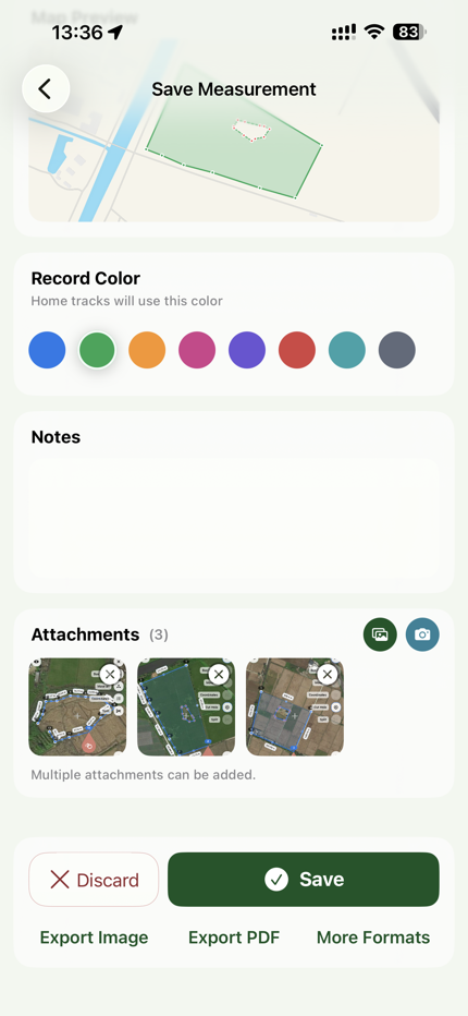
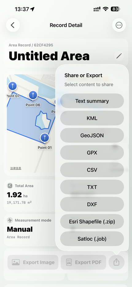
KML, Image, PDF, GeoJSON, Shapefile, CSV, DXF, TXT, GPX, Satloc(.job)

Import

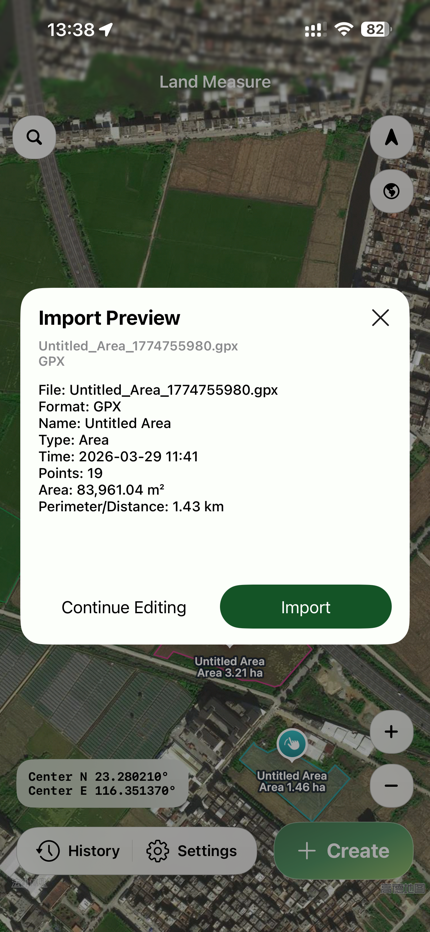
GeoJSON/JSON, KML, GPX, CSV, TXT, DXF, JOB

Capabilities may evolve by version; always refer to the current in-app feature set.

Pro Value

  • No watermark on image exports
  • More complete professional workflow
  • iCloud sync across devices
  • Advanced editing and export flow

Use Cases

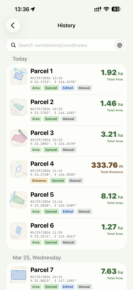
Field acreage checks, parcel boundary confirmation, site inspection, engineering survey, and geospatial handoff.

If you need records that stay editable and export-ready after field work, this app is designed for that workflow.